
Research Projects
This page has information about a few of my past and present research projects.
NNA: Remote Sensing of Arctic Sea Ice using the Super Dual Auroral Radar Network
This project analyzed historical and ongoing SuperDARN ground/sea backscatter data for comparison to sea ice measurements obtained from space-based microwave remote sensors. Improvements made in the detection and geolocation of SuperDARN ground/sea backscatter echoes have not only benefited studies of land/sea surface features in radar observations but also increased the quality of global space weather maps of ionospheric plasma convection. As a contributor to the Arctic Observing Network (AON) program, monthly files containing daily maps of ground/sea backscatter occurrence from 7 SuperDARN radars (shaded red in the attached figure) have been delivered to the National Science Foundation’s Arctic Data Center and are available in NetCDF-format here.
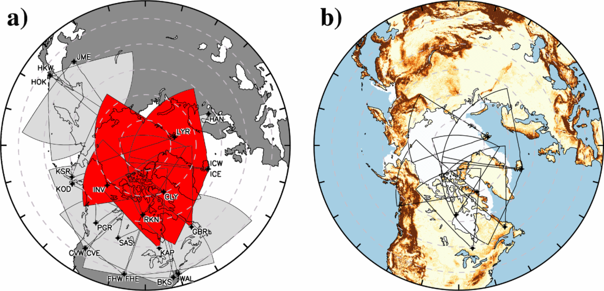 Figure: (a) Fields of view (FOVs) of the Northern Hemisphere SuperDARN radars in geographic coordinates. Radars for which data have been submitted to the Arctic Data Center are shaded red. (b) Interactive Multisensor Snow and Ice Mapping System (IMS) 24 km sea ice extent for 01 January 2023 (white pixels) and GMTED2010-derived land surface roughness (yellow-brown pixels), with contributing radar FOVs overlaid in black.
Empirical Ionospheric Convection Modeling
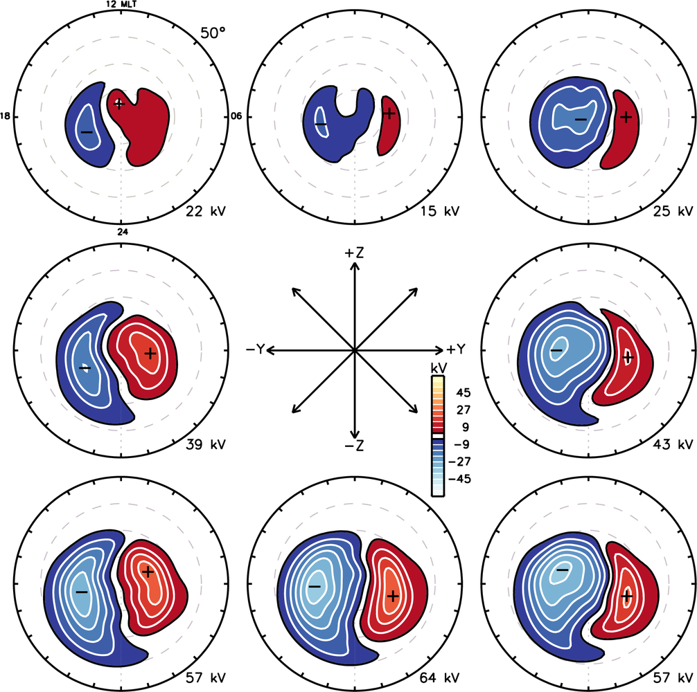 Figure: Statistical convection patterns sorted by interplanetary magnetic fiield clockangle for 1.6 ≤ Esw < 2.1 mV/m and neutral dipole tilt. Electrostatic potential is indicated by color according to the scale near the center of the fiigure, and equipotential contours are plotted at 6-kV intervals beginning at ±3kV.The patterns are rotated so that noon (12 magnetic local time, MLT) is at the top with dawn (06MLT) on the right and dusk (18MLT) on the left. After Thomas and Shepherd (2018).